
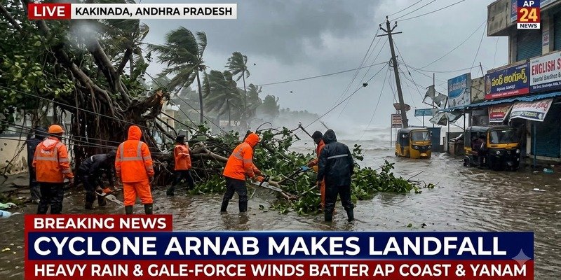
KAKINADA: It was a long, loud night for people along the Andhra Pradesh coast. Severe Cyclone Arnab made landfall early on Wednesday, bringing winds that tore at trees and rain that hasn’t let up. The storm crossed between Kakinada and Yanam, a small part of Puducherry that sits inside Andhra Pradesh.
Here is the odd part. Arnab is barely moving. It is drifting northwest at just 3 kmph. But the winds around it are anything but slow. They are blowing steadily at 125 to 135 kmph, and gusts have hit 150 kmph.
The India Meteorological Department (IMD), the country’s weather agency, had expected the cyclone to cross the coast somewhere between Bapatla and Visakhapatnam, south of Yanam. It also warned of a storm surge. In simple words, that is seawater being pushed inland by strong winds. The sea could rise 1.5 to 2.5 metres above the normal high tide, and areas near Kakinada and Yanam, which sit low, could go under water.
The damage has already begun. In Kakinada, trees came down and power lines snapped in several places. Over in Visakhapatnam, fallen trees blocked Beach Road and Seethammadhara after hours of rain and wind.
And the rain? Between 8:30 am on October 27 and 3 am on October 28, the IMD recorded more than 200 mm at several places in Anakapalli and Visakhapatnam districts. That is over 20 centimetres in less than a day. West Bengal has also seen heavy rain and strong winds in some parts.
Officials have a clear message for residents: stay indoors until things get better, and keep away from electric poles, hoardings and old trees. Emergency teams are out in the most at-risk areas. They are clearing waterlogged roads, cutting up fallen trees, opening blocked routes and fixing damage to essential services.
Odisha next in line
The cyclone’s effects are now reaching Odisha. The IMD has issued colour-coded warnings for many districts there. Yellow means stay aware. Orange means be ready.
The strictest warning covers Gajapati, Ganjam, Rayagada, Koraput, Nabarangpur and Malkangiri. Heavy to very heavy rain is likely, and a few spots could get extremely heavy rain. Thunder, lightning and winds of 60 to 80 kmph are also expected, with gusts up to 90 kmph.
Orange warnings are out for Kalahandi, Kandhamal, Nuapada, Balangir, Bargarh, Puri, Khordha, Sonepur, Boudh and Nayagarh. These districts may see heavy to very heavy rain, thunderstorms and winds of 40 to 50 kmph, with gusts of up to 60 kmph.
Yellow warnings cover Sundargarh, Jharsuguda, Sambalpur, Deogarh, Mayurbhanj, Angul, Dhenkanal, Keonjhar, Balasore, Bhadrak, Jajpur, Kendrapara, Jagatsinghapur and Cuttack. Some places there could get heavy rain along with thunderstorms and winds of 30 to 40 kmph, with gusts of up to 50 kmph.
The rain has already reached the state. Chandbali and Dhamnagar each recorded more than 50 mm as the cyclonic storm crossed the Andhra Pradesh and Yanam coasts. Visuals shared by the news agency PTI showed heavy rain falling in parts of Odisha.
For now, people living near the coast or in low-lying areas have been asked to follow local officials and keep checking official weather updates. Some roads may stay blocked and power may stay off for a while. The situation is still changing, and the weather in Andhra Pradesh, Odisha and West Bengal could shift fast.